
Explore the Wabash & erie canal, one step at a time
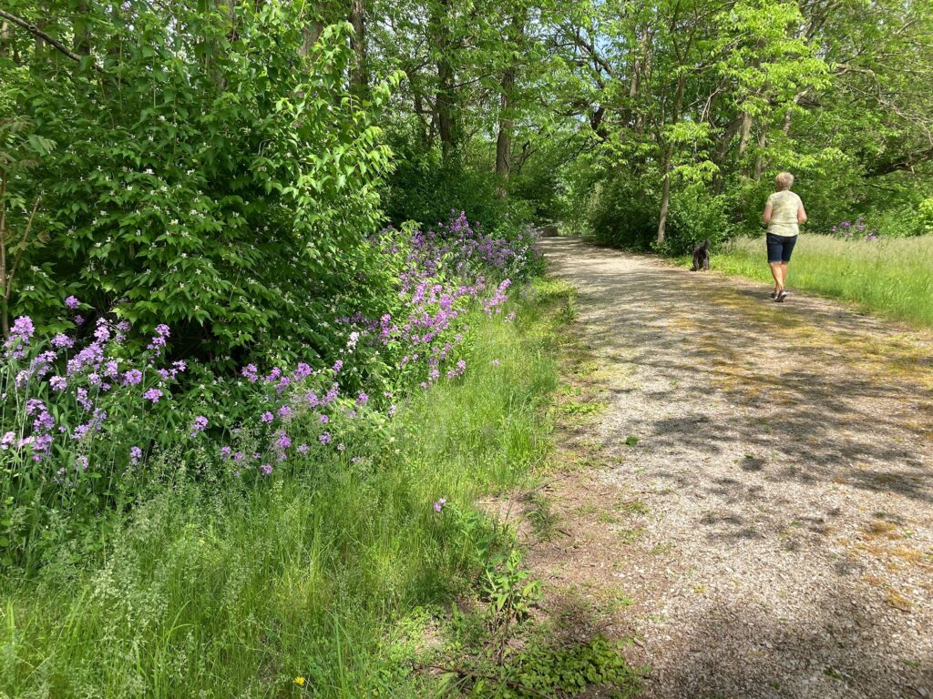
We are proud to maintain approximately six miles of trails in and around Delphi, Indiana as part of the network of Delphi Historic Trails. Click below to view the full map of the trail network!
Trail Descriptions
Our trails run along the Wabash River, Deer Creek, and the watered remnants of the Wabash & Erie Canal. Hikers and bikers can also enjoy architectural and historical gems throughout the City of Delphi’s trails.
Some of these trails were once the towing path walked by mules and horses pulling canal boats. Today we welcome activities like hiking, biking, birdwatching, fishing, and even cross-county skiing.
Multiple parking areas and access points are open year-round from dawn to dusk, free of charge. There are several National Register sites to visit along the trails, including the 1838-1839 Canal Construction Camp site, Lock #33 and the adjacent lockkeeper’s home site, and the 1857 Harley and Hubbard Lime Kiln site.
Underhill Towpath Trail
0.9 miles
Running between US 421 and North Washington Street, this trail crosses over the Wabash & Erie Canal and runs through the heart of Canal Park.
Founders Towpath Trail
0.5 miles
Between North Washington Street and Founders Point, this trail follows the route of the original towpath along the canal. Near Founders Point you will find the “tumble,” where US Aggregates pumps three million gallons of fresh water into the canal each day.
Draper North End Trail
0.9 miles
This trail runs along the east side of the canal from Founders Point down to the replica guard lock on the south side of Canal Park. Located on the opposite side of where the towpath once was, this trail includes points of interest at the Red Bridge Settlement and great views of the Pioneer Village and Interpretive Center.
Belt Railroad Trail
0.25 miles
This short spur follows the line where the Belt Railroad used to run. One end of the trail outlets to Carrollton Road in Delphi, while the other end places you at the Red Bridge where a train bridge was once located.
VanScoy Towpath Trail
0.9 miles
This trail follows the towpath along the canal starting at the Blue Bridge. Parking is available just off Bicycle Bridge Road, and it features a view of the canal sidecut, the Lock No. 33 site, and the confluence of Deer Creek, the canal, and the Wabash River at Sunset Point.
Obear Millrace Loop Trail
0.6 miles
This trail forms a loop with the VanScoy Towpath Trail, and it traces the former millrace where canal water once powered the paper mills that helped drive local industry.
Robbins Trail
0.4 miles
This short trail connects the two south trail loops (VanScoy Towpath and Happy Jack’s Loop). This trail crosses the canal and follows a shale bluff along Deer Creek, passing under Old State Road 25 near the scenic Deer Creek Falls.
Happy Jack’s Loop
0.7 miles
This beautiful trail can be easily accessed from the BP parking lot at Main Street and US 421. It follows the modern Norfolk-Southern railroad line until it reaches Deer Creek and its scenic overlooks.
Interurban Trail
0.4 miles
This trail comprises the west side of a loop with Happy Jack’s Trail. It sits upon the historic route of the Interurban Railroad, which used to cross Deer Creek near the Deer Creek Falls. Today, this bridge is still evident from the remnants visible near Old State Road 25.
Campbell Ridge Trail
0.3 miles
This trail can be accessed from a small parking area just south of Trailhead Park on Old State Road 25. It runs along a steep ridge overlooking Sunset Point and the place where the Wabash & Erie Canal met its demise in our part of Indiana.
Downtown Loop Trail
1 mile, City of Delphi Trail
Beginning near US 421 and heading downtown, this urban trail connects the outlying canal trails with the Delphi Courthouse Square National Register Historic District. It passes by beautiful and architecturally noteworthy residential and commercial buildings. Antique stores, clothing shops, and restaurants dot this charming area.
Riley-City Trail
0.8 miles, City of Delphi Trail
This urban trail runs past many architecturally significant homes in Delphi and passes through Riley Park, named for Hoosier poet James Whitcomb Riley. The trail crosses Deer Creek twice, once over a suspension bridge, and allows easy passage below Washington Street to enjoy all that Riley Park offers.
Gateway Trail
1 mile, City of Delphi Trail
This trail starts as a stone trail from the Gray Bridge at Canal Park, winds past the Carroll County Historical Society Museum, follows Washington Street through Delphi’s Courthouse Square, and it eventually reaches the facilities of Delphi Community Schools.
Monon High Bridge Trail
1 mile, City of Delphi Trail
Parking can be accessed from Miller Park off Old Camden Road, and this paved trail includes access to the Indiana Centennial Stone, dedicated to General Samuel Milroy, who platted Delphi in 1828. Also nearby is a small park with the Bicentennial Monument, which honors Indiana’s 200th birthday. The trail crosses Freedom Bridge and runs along a high bluff overlooking Deer Creek. There is a connection to a NICHES Land Trust trail down to the banks of Deer Creek at the Mary Gerard Nature Reserve. Finally, visitors can enjoy a breathtaking view of the creek from the Monon High Bridge, Indiana’s second-longest and third-highest rail trestle.